Nemrut Dağı
Location: 38.65° N, 42.23° E
Elevation: 2.948 m
Nemrut Dağı is a polygenic stratovolcano located in the collision zone of the Arabian and
Eurasian tectonic plates, which determines the
seismic and volcanic activity in the region. The
collision of these plates began in the Middle
Eocene and closed the stretch of water, which
in the Mesozoic formed the Tethys Ocean.
Nemrut, along with three other extinct
volcanoes of eastern Turkey: Ararat, Tendürek
and Süphan, is located in the area of a complex
fault, which runs along the boundary of the
Arabian and Eurasian plates in the territory of
the Armenian Highland. It is the westernmost of
these volcanoes, the only one that remains
active, and generally the only volcano in
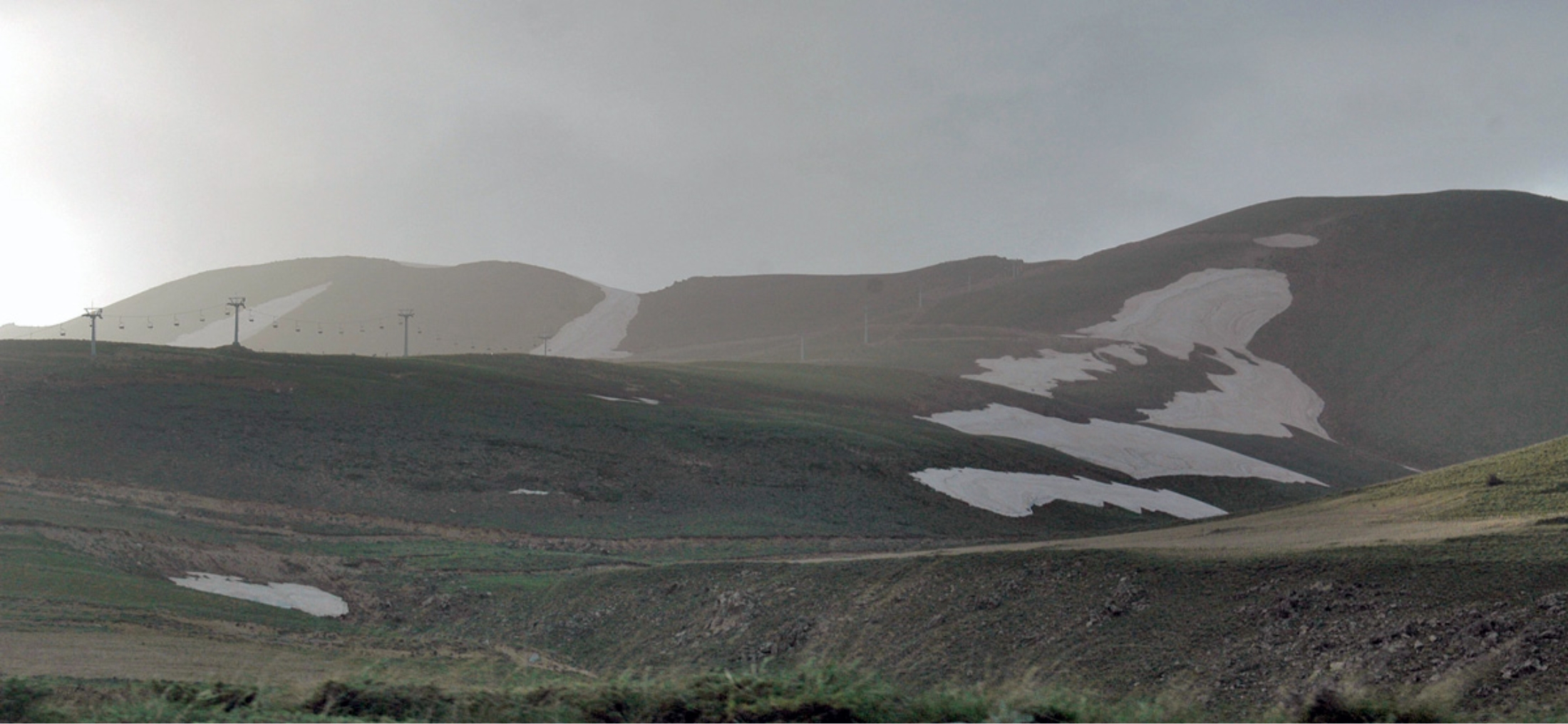
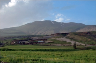
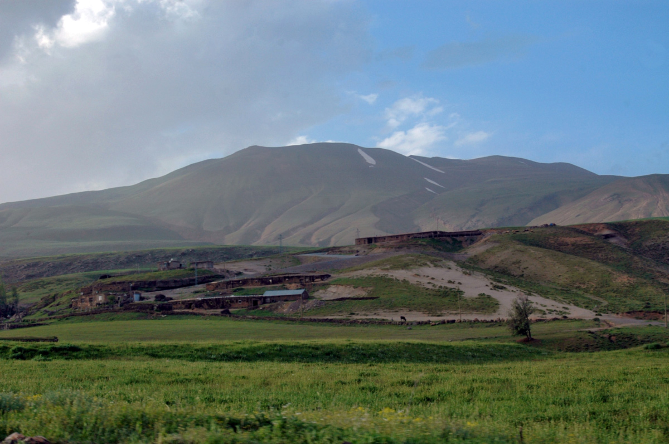
Anatolia, which erupted in the historical period. Nemrut is located 10 km north of the city Tatvan, in
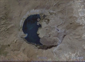
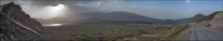
the north-western shore of Lake Van. Nemrut was probably formed in the early Quaternary Period,
about 1 million years ago. It showed the greatest activity in the Pleistocene, with regular eruptions
occurring in the Holocene. In the middle Pleistocene, about 250,000 years ago, a major eruption
formed a lava flow over 60 km long, which blocked the water discharge from the Van basin and
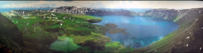
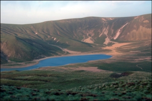
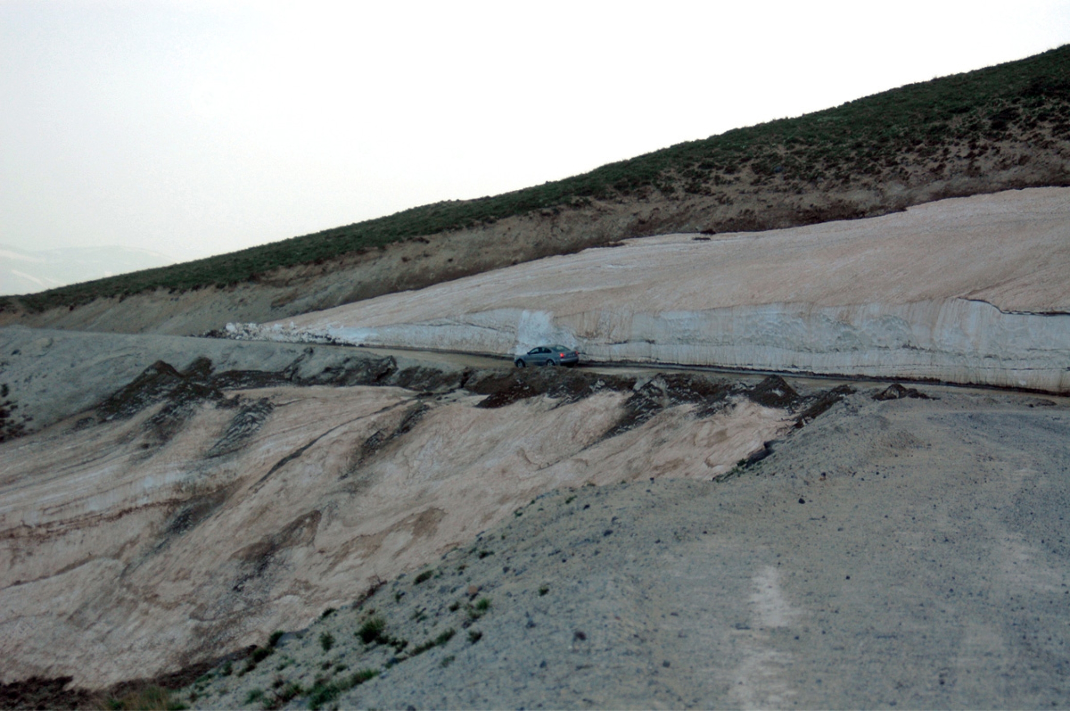
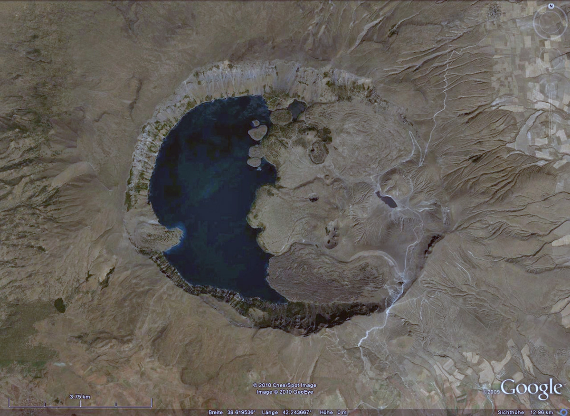
formed Lake Van, the world's largest alkali endorheic lake. In the same period, the conical top of
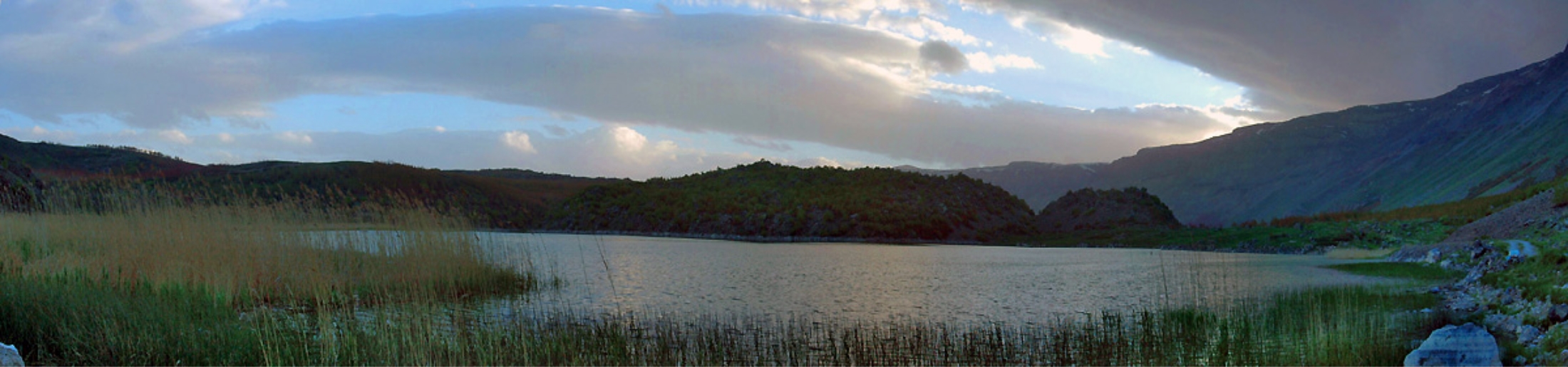
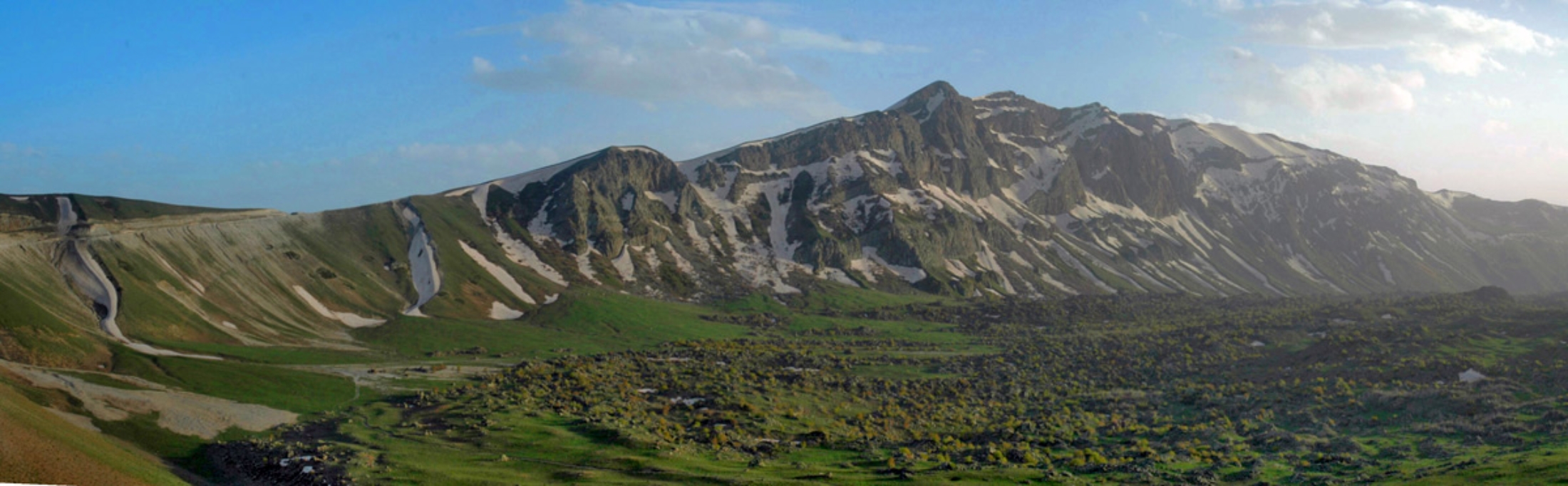
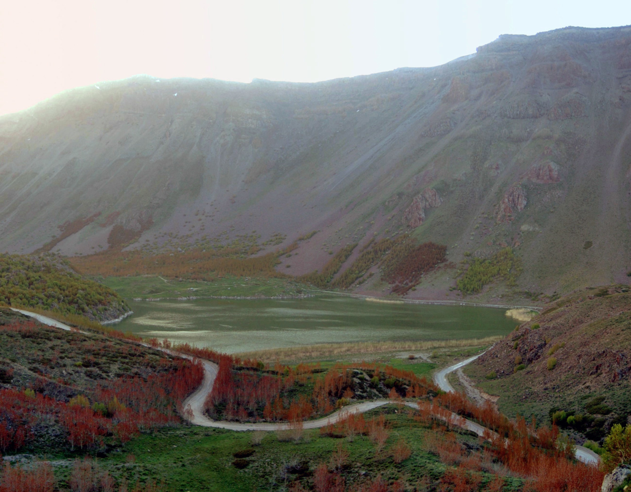
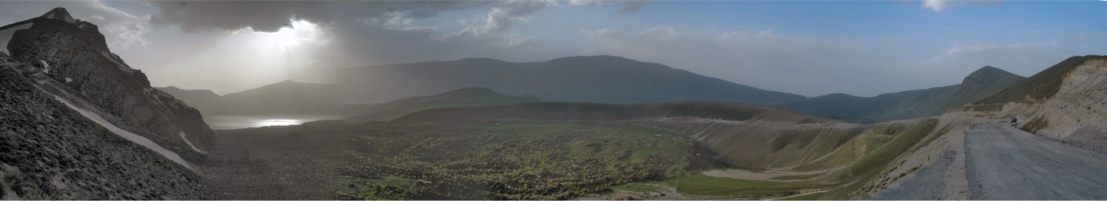
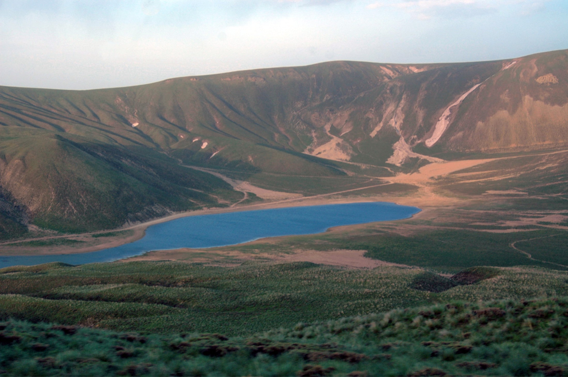
the volcano collapsed inward, forming a 8.3×7 km caldera. Later, the freshwater Lake Nemrut
formed inside the caldera, becoming the world's second largest caldera lake. Nemrut volcano has
an elliptical shape, its size at the base is 27×18 km, and its center contains 377.5 km3 of volcanic
materials. The caldera of Nemrut is the largest in Turkey, the fourth largest in Europe and sixteenth
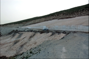
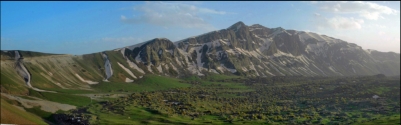
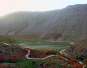
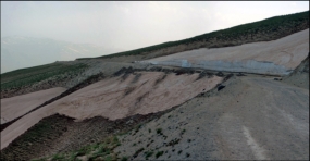
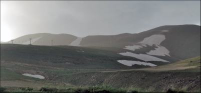
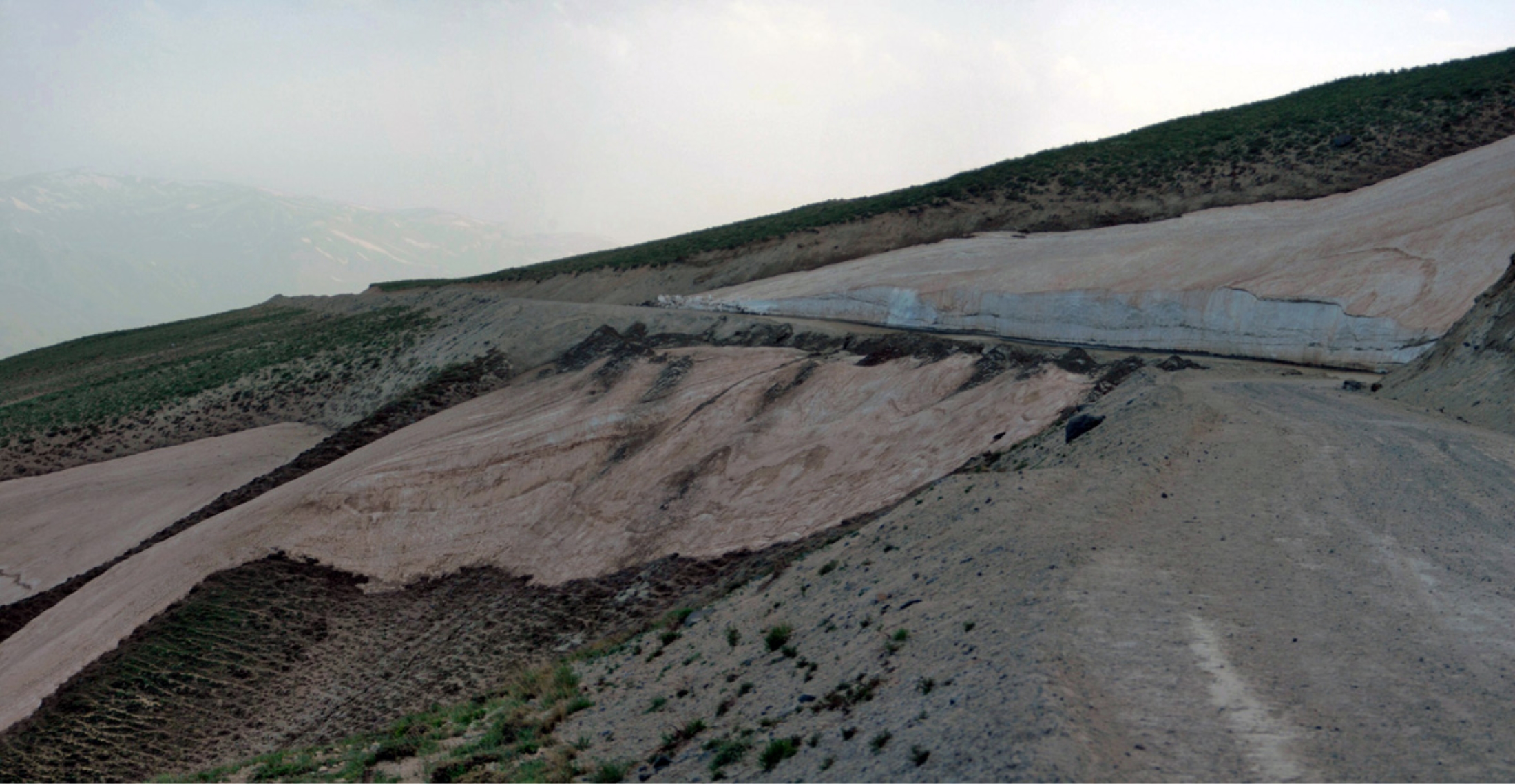
largest in the world. Post-caldera volcanism, of basaltic to rhyolitic composition, initially occurred
along the caldera rim and floor. Pyroclastic flows and the emission of glassy obsidian lava flows
accompanied construction of lava domes within the caldera; later activity formed a series of cinder
cones and lava domes erupted along N-S-trending fissures on the northern flank. The most recent
activity has been concentrated along a NNW-trending fissure cutting the eastern caldera floor and
extending beyond the north caldera rim; nearly two dozen cinder cones and lava domes were
constructed on the caldera floor. Ash layers in Lake Van document numerous Holocene eruptions,
and an historical eruption in 1441 AD from a north-flank fissure involved compositionally bimodal
lava flows.
located in the collision zone of the Arabian and
Eurasian tectonic plates, which determines the
seismic and volcanic activity in the region. The
collision of these plates began in the Middle
Eocene and closed the stretch of water, which
in the Mesozoic formed the Tethys Ocean.
Nemrut, along with three other extinct
volcanoes of eastern Turkey: Ararat, Tendürek
and Süphan, is located in the area of a complex
fault, which runs along the boundary of the
Arabian and Eurasian plates in the territory of
the Armenian Highland. It is the westernmost of
these volcanoes, the only one that remains
active, and generally the only volcano in
Anatolia, which erupted in the historical period. Nemrut is located 10 km north of the city Tatvan, in
the north-western shore of Lake Van. Nemrut was probably formed in the early Quaternary Period,
about 1 million years ago. It showed the greatest activity in the Pleistocene, with regular eruptions
occurring in the Holocene. In the middle Pleistocene, about 250,000 years ago, a major eruption
formed a lava flow over 60 km long, which blocked the water discharge from the Van basin and
formed Lake Van, the world's largest alkali endorheic lake. In the same period, the conical top of
the volcano collapsed inward, forming a 8.3×7 km caldera. Later, the freshwater Lake Nemrut
formed inside the caldera, becoming the world's second largest caldera lake. Nemrut volcano has
an elliptical shape, its size at the base is 27×18 km, and its center contains 377.5 km3 of volcanic
materials. The caldera of Nemrut is the largest in Turkey, the fourth largest in Europe and sixteenth
largest in the world. Post-caldera volcanism, of basaltic to rhyolitic composition, initially occurred
along the caldera rim and floor. Pyroclastic flows and the emission of glassy obsidian lava flows
accompanied construction of lava domes within the caldera; later activity formed a series of cinder
cones and lava domes erupted along N-S-trending fissures on the northern flank. The most recent
activity has been concentrated along a NNW-trending fissure cutting the eastern caldera floor and
extending beyond the north caldera rim; nearly two dozen cinder cones and lava domes were
constructed on the caldera floor. Ash layers in Lake Van document numerous Holocene eruptions,
and an historical eruption in 1441 AD from a north-flank fissure involved compositionally bimodal
lava flows.

 22. May 2010
HOME
22. May 2010
HOME

located in the collision zone of the Arabian and
Eurasian tectonic plates, which determines the
seismic and volcanic activity in the region. The
collision of these plates began in the Middle
Eocene and closed the stretch of water, which
in the Mesozoic formed the Tethys Ocean.
Nemrut, along with three other extinct
volcanoes of eastern Turkey: Ararat, Tendürek
and Süphan, is located in the area of a complex
fault, which runs along the boundary of the
Arabian and Eurasian plates in the territory of
the Armenian Highland. It is the westernmost of
these volcanoes, the only one that remains
active, and generally the only volcano in
Anatolia, which erupted in the historical period. Nemrut is located 10 km north of the city Tatvan, in
the north-western shore of Lake Van. Nemrut was probably formed in the early Quaternary Period,
about 1 million years ago. It showed the greatest activity in the Pleistocene, with regular eruptions
occurring in the Holocene. In the middle Pleistocene, about 250,000 years ago, a major eruption
formed a lava flow over 60 km long, which blocked the water discharge from the Van basin and
formed Lake Van, the world's largest alkali endorheic lake. In the same period, the conical top of
the volcano collapsed inward, forming a 8.3×7 km caldera. Later, the freshwater Lake Nemrut
formed inside the caldera, becoming the world's second largest caldera lake. Nemrut volcano has
an elliptical shape, its size at the base is 27×18 km, and its center contains 377.5 km3 of volcanic
materials. The caldera of Nemrut is the largest in Turkey, the fourth largest in Europe and sixteenth
largest in the world. Post-caldera volcanism, of basaltic to rhyolitic composition, initially occurred
along the caldera rim and floor. Pyroclastic flows and the emission of glassy obsidian lava flows
accompanied construction of lava domes within the caldera; later activity formed a series of cinder
cones and lava domes erupted along N-S-trending fissures on the northern flank. The most recent
activity has been concentrated along a NNW-trending fissure cutting the eastern caldera floor and
extending beyond the north caldera rim; nearly two dozen cinder cones and lava domes were
constructed on the caldera floor. Ash layers in Lake Van document numerous Holocene eruptions,
and an historical eruption in 1441 AD from a north-flank fissure involved compositionally bimodal
lava flows.


 22. May 2010
HOME
22. May 2010
HOME