
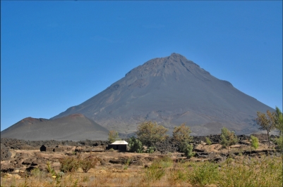
The Pico do Fogo on the island of Fogo is the highest peak of the Cape Verde
islands with a height of 2,829 m and after
the Pico del Teide, the second highest in
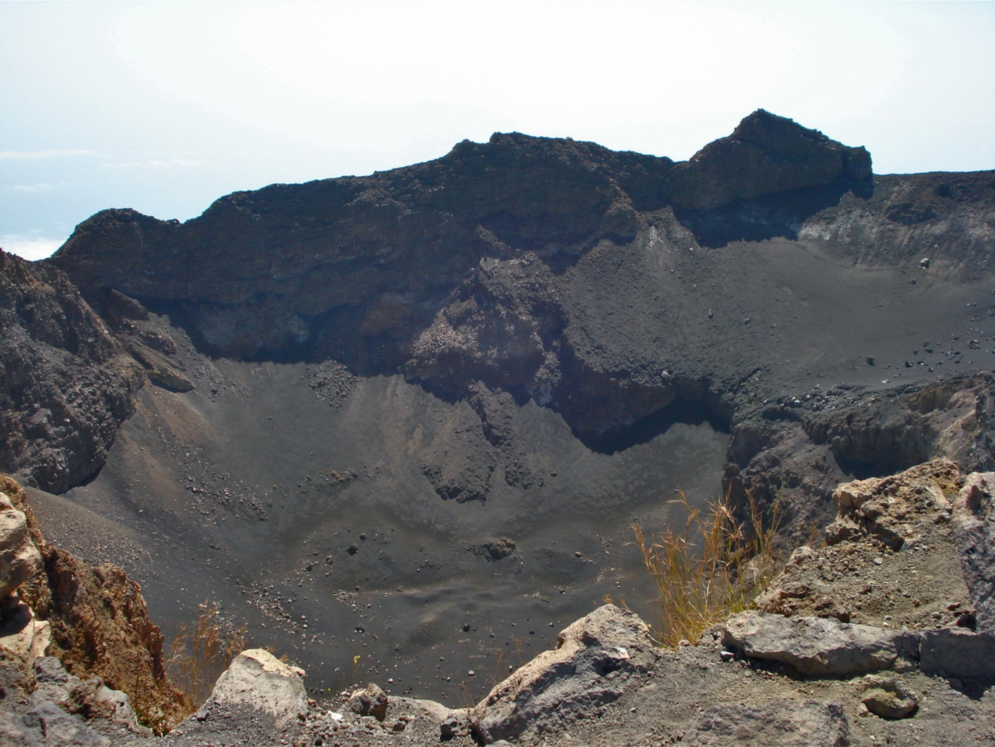
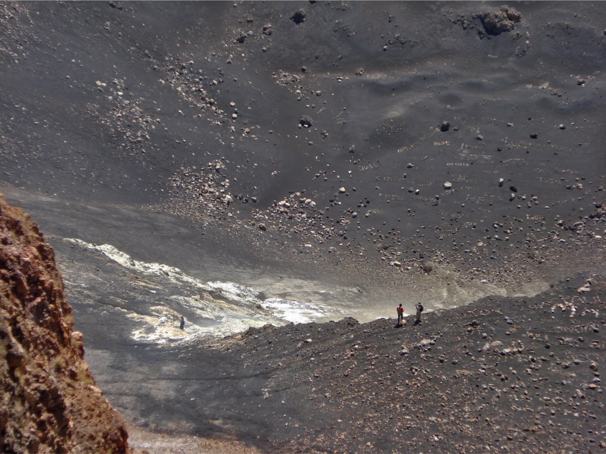
Atlantic. The central crater of the volcano
reached with a diameter of 500 meters a
depth of 180 meters. The layer volcano
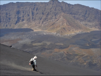
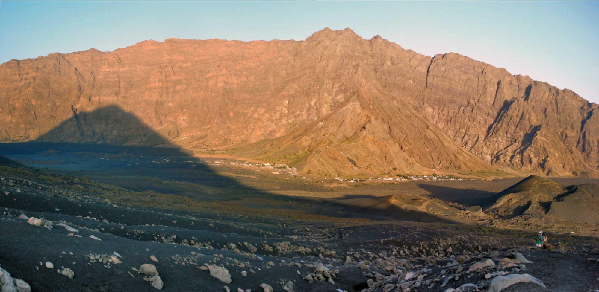
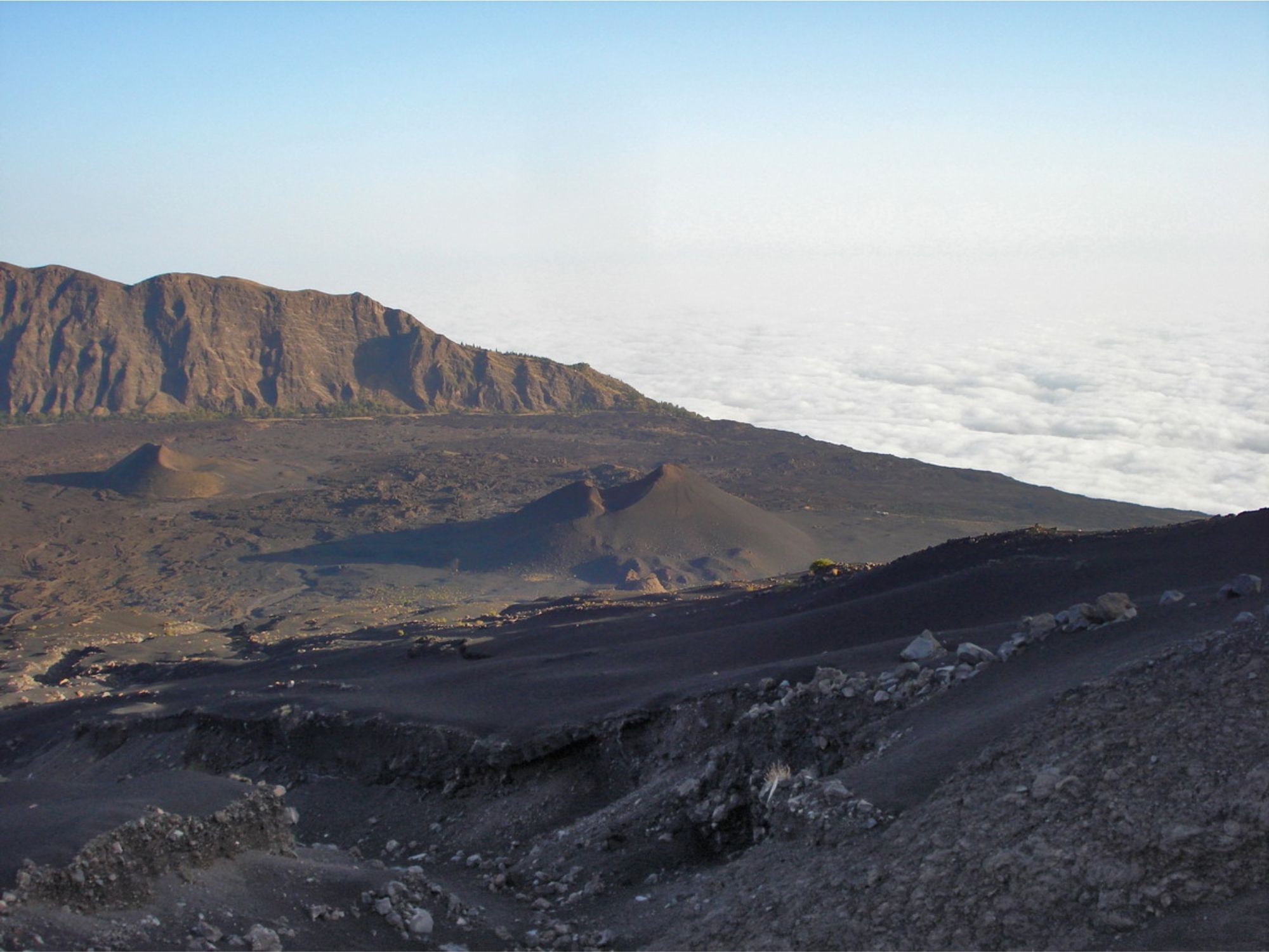
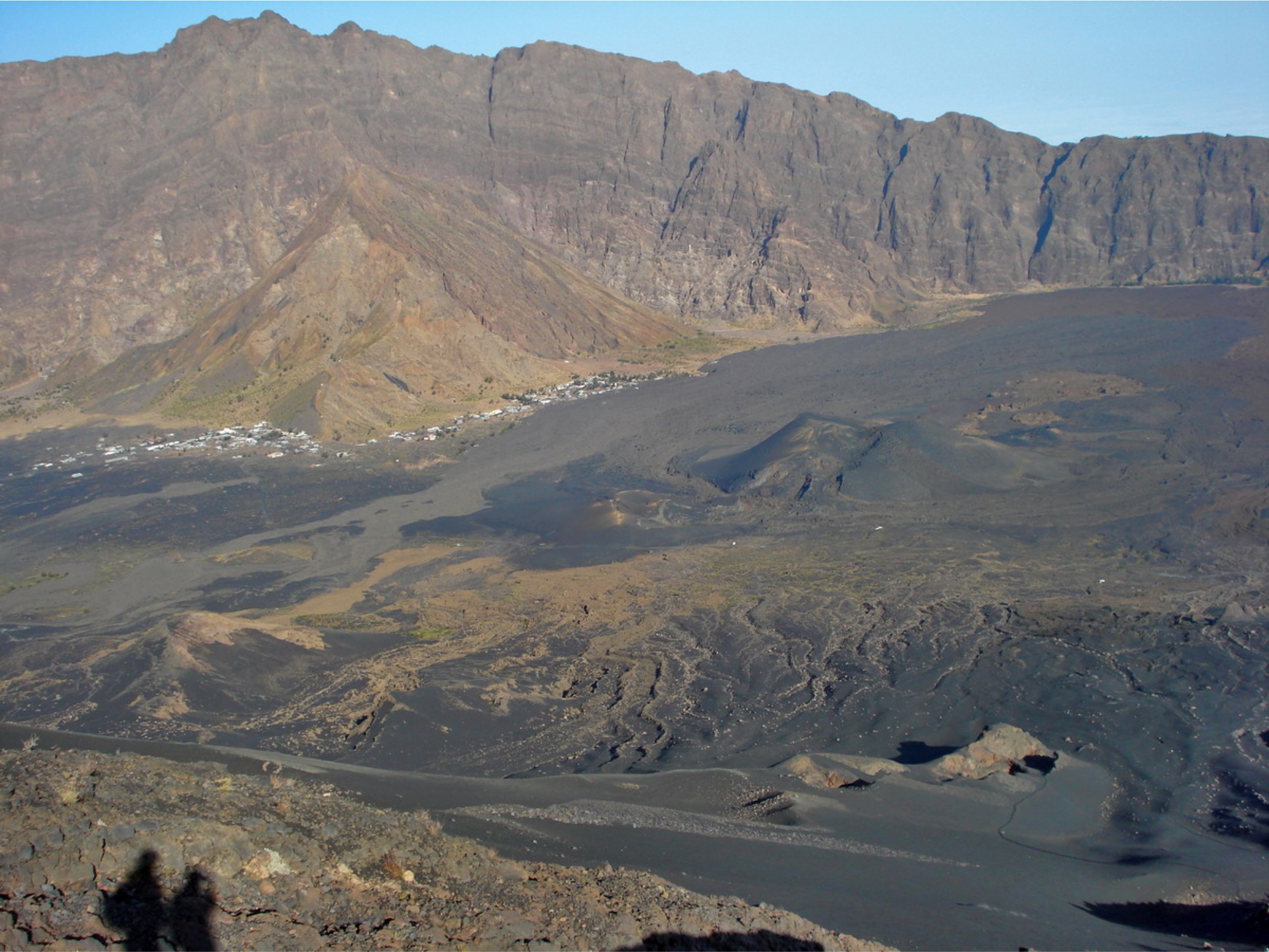
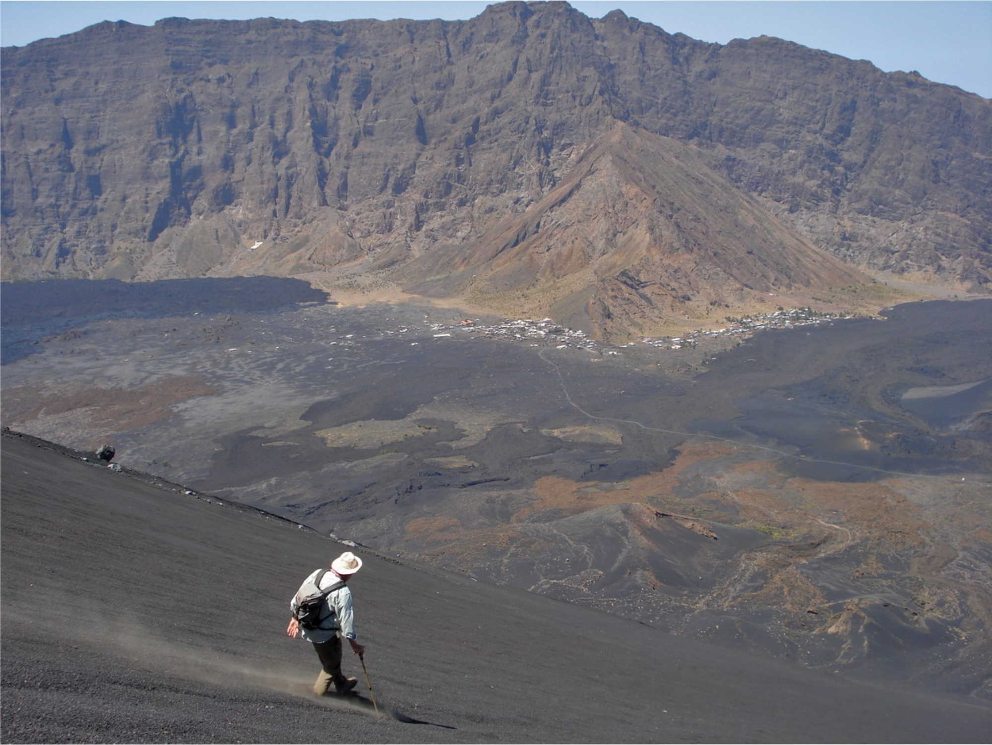
rises 1200 m above the east side of the
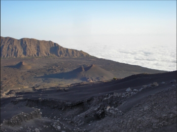
Cha das Caldeira , which has a semi-
circular rock basin at an altitude of 1600 m
and 1700 m above the sea represents a
diameter of about 9 km . However, Cha
das Caldeira is not a classical collapse
crater (caldera), it is caused by a huge landslide , after then on the east side the layer
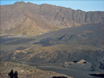
volcanic cone was built up. The south and west of the Chã das Caldeira is dominated of
almost 1000 m high vertical cliffs , the Bordeira de Fogo. After a violent eruption from the
central crater of Pico in 1680 the island " São Filipe ," became the todays name “Fogo”
(Fire) . In the years 1785 , 1799 , 1847 , 1852 , 1857 and 1951, followed further eruptions.
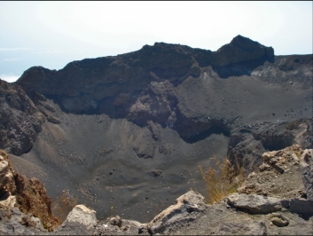
During the last eruption on 2 April 1995 a tributary volcano
(Pico Pequeno 1,950 m) was built at the western flank of the Pico . After the eruption of
the Pico Pequeno large parts of the cultural landscape were destroyed in the Caldeira ,
the 2000 residents were temporarily evacuated. As before the living conditions are simple,
there is no public water and power supply. Burgeoning tourism and a wine cooperative are
the main sources of income . The Pico is part of a nature reserve. For the strenuous, but
not particularly difficult hike to the summit accompanied by a mountain guide prescribed.
On the eastern slopes of the Pico grown inter alia coffee, beans and corn.
Pico do Fogo
Location: 14°57'0'' N, 24°21'0'' W
Elevation: 2.829 m
the highest peak of the Cape Verde
islands with a height of 2,829 m and after
the Pico del Teide, the second highest in
Atlantic. The central crater of the volcano
reached with a diameter of 500 meters a
depth of 180 meters. The layer volcano
rises 1200 m above the east side of the
Cha das Caldeira , which has a semi-
circular rock basin at an altitude of 1600 m
and 1700 m above the sea represents a
diameter of about 9 km . However, Cha
das Caldeira is not a classical collapse
crater (caldera), it is caused by a huge landslide , after then on the east side the layer
volcanic cone was built up. The south and west of the Chã das Caldeira is dominated of
almost 1000 m high vertical cliffs , the Bordeira de Fogo. After a violent eruption from the
central crater of Pico in 1680 the island " São Filipe ," became the todays name “Fogo”
(Fire) . In the years 1785 , 1799 , 1847 , 1852 , 1857 and 1951, followed further eruptions.
During the last eruption on 2 April 1995 a tributary volcano
(Pico Pequeno 1,950 m) was built at the western flank of the Pico . After the eruption of
the Pico Pequeno large parts of the cultural landscape were destroyed in the Caldeira ,
the 2000 residents were temporarily evacuated. As before the living conditions are simple,
there is no public water and power supply. Burgeoning tourism and a wine cooperative are
the main sources of income . The Pico is part of a nature reserve. For the strenuous, but
not particularly difficult hike to the summit accompanied by a mountain guide prescribed.
On the eastern slopes of the Pico grown inter alia coffee, beans and corn.
Pico do Fogo
Location: 14°57'0'' N, 24°21'0'' W
Elevation: 2.829 m


 HOME
Cha das Caldeiras, 28.02.2010
HOME
Cha das Caldeiras, 28.02.2010
the highest peak of the Cape Verde
islands with a height of 2,829 m and after
the Pico del Teide, the second highest in
Atlantic. The central crater of the volcano
reached with a diameter of 500 meters a
depth of 180 meters. The layer volcano
rises 1200 m above the east side of the
Cha das Caldeira , which has a semi-
circular rock basin at an altitude of 1600 m
and 1700 m above the sea represents a
diameter of about 9 km . However, Cha
das Caldeira is not a classical collapse
crater (caldera), it is caused by a huge landslide , after then on the east side the layer
volcanic cone was built up. The south and west of the Chã das Caldeira is dominated of
almost 1000 m high vertical cliffs , the Bordeira de Fogo. After a violent eruption from the
central crater of Pico in 1680 the island " São Filipe ," became the todays name “Fogo”
(Fire) . In the years 1785 , 1799 , 1847 , 1852 , 1857 and 1951, followed further eruptions.
During the last eruption on 2 April 1995 a tributary volcano
(Pico Pequeno 1,950 m) was built at the western flank of the Pico . After the eruption of
the Pico Pequeno large parts of the cultural landscape were destroyed in the Caldeira ,
the 2000 residents were temporarily evacuated. As before the living conditions are simple,
there is no public water and power supply. Burgeoning tourism and a wine cooperative are
the main sources of income . The Pico is part of a nature reserve. For the strenuous, but
not particularly difficult hike to the summit accompanied by a mountain guide prescribed.
On the eastern slopes of the Pico grown inter alia coffee, beans and corn.
Pico do Fogo
Location: 14°57'0'' N, 24°21'0'' W
Elevation: 2.829 m

 HOME
Cha das Caldeiras, 28.02.2010
HOME
Cha das Caldeiras, 28.02.2010