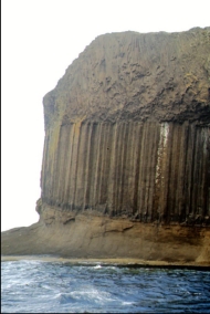
In pre-historic times Staffa was covered by the ice sheets which spread from Scotland out into the Atlantic Ocean beyond the
Outer Hebrides. After the last retreat of the ice around
20,000 years ago, sea levels were up to 125 m lower than at
present. Steadily rising sea levels since that time then further
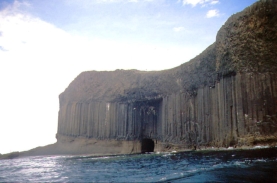
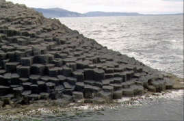
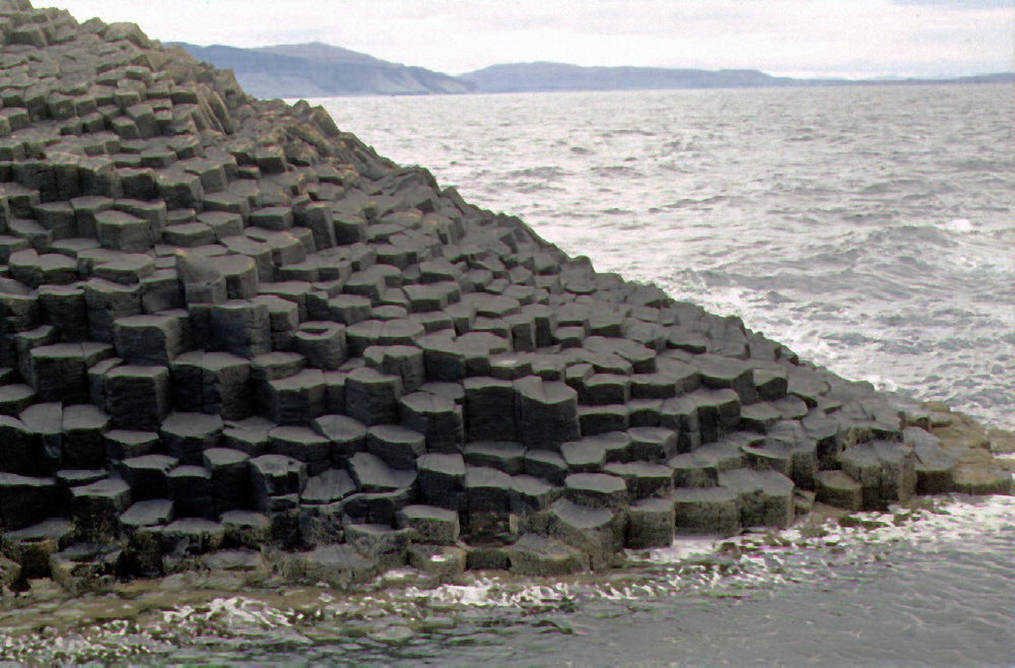
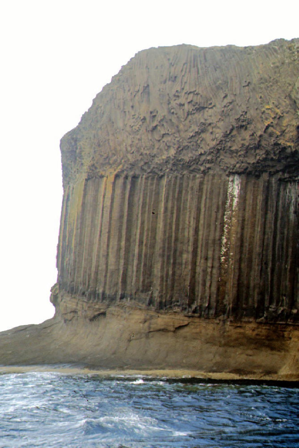
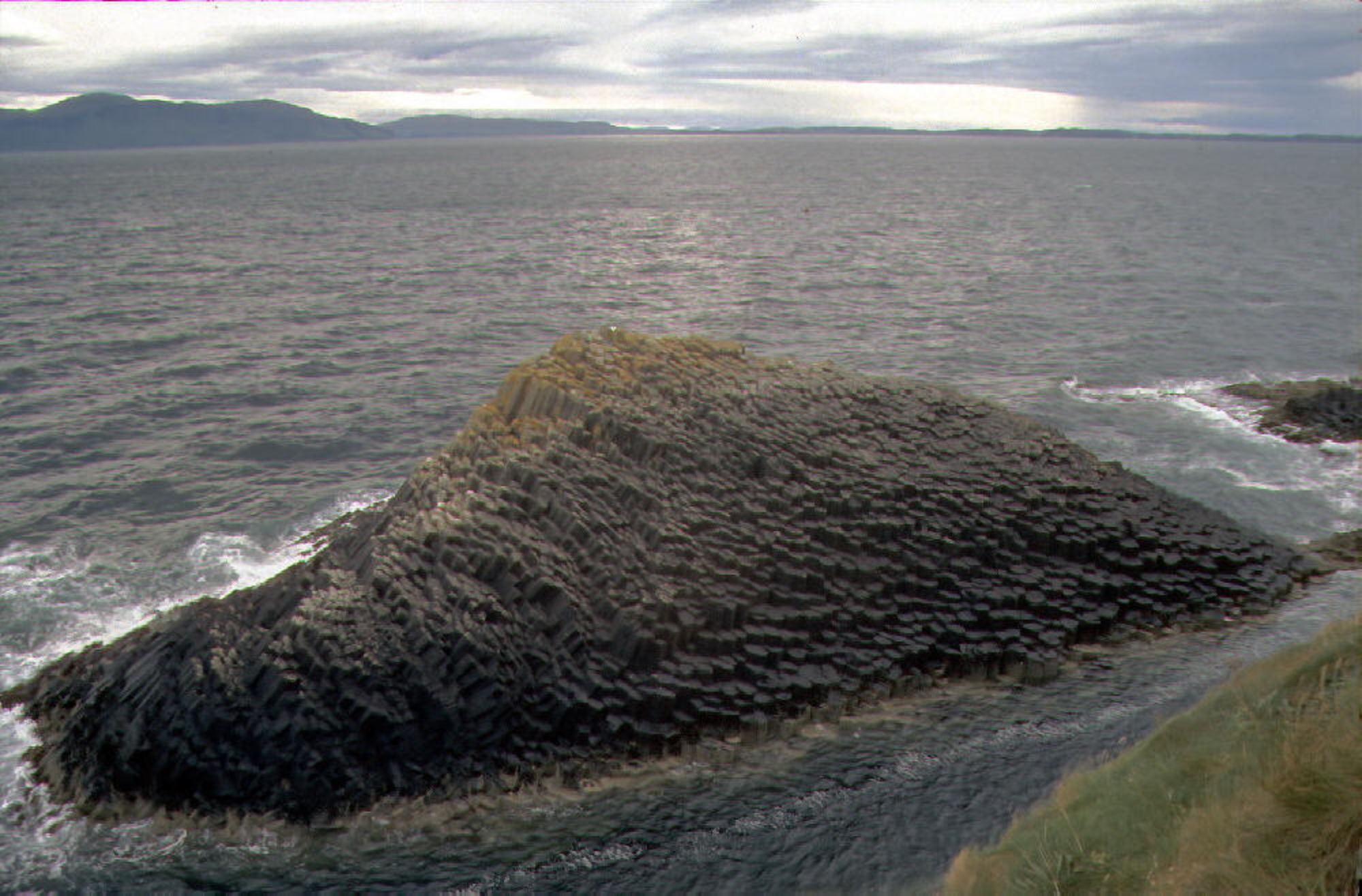
isolated this little island, which is entirely of volcanic origin. It
consists of a basement of tuff, underneath colonnades of a black
fine-grained Tertiary basalt, overlying which is a third layer of
basaltic lava lacking a crystalline structure. By contrast, slow
cooling of the second layer of basalt resulted in an extraordinary
pattern of predominantly hexagonal columns which form the faces and walls of the principal caves.
The lava contracted towards each of a series of equally spaced centres as it cooled and solidified
into prismatic columns. The columns typically have three to eight sides, six being most common.
The columns are also divided horizontally by cross joints.
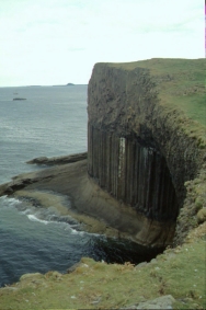
Similar formations are found at the Giant`s Causeway in Nothern Ireland, on the island of Ulva and
at Ardmeanach on the Isle of Mull. Grooves in the roof of MacKinnon's cave indicate either a
pyroclastic flow or a series of eroded ash falls in the rock above the columnar basalt.The 'Staffa
Group' is the name given to the series of olivine tholeiite basalts found in the vicinity of Mull which
erupted 55–58 million years ago.
spread from Scotland out into the Atlantic Ocean beyond the
Outer Hebrides. After the last retreat of the ice around
20,000 years ago, sea levels were up to 125 m lower than at
present. Steadily rising sea levels since that time then further
isolated this little island, which is entirely of volcanic origin. It
consists of a basement of tuff, underneath colonnades of a black
fine-grained Tertiary basalt, overlying which is a third layer of
basaltic lava lacking a crystalline structure. By contrast, slow
cooling of the second layer of basalt resulted in an extraordinary
pattern of predominantly hexagonal columns which form the faces and walls of the principal caves.
The lava contracted towards each of a series of equally spaced centres as it cooled and solidified
into prismatic columns. The columns typically have three to eight sides, six being most common.
The columns are also divided horizontally by cross joints.
Similar formations are found at the Giant`s Causeway in Nothern Ireland, on the island of Ulva and
at Ardmeanach on the Isle of Mull. Grooves in the roof of MacKinnon's cave indicate either a
pyroclastic flow or a series of eroded ash falls in the rock above the columnar basalt.The 'Staffa
Group' is the name given to the series of olivine tholeiite basalts found in the vicinity of Mull which
erupted 55–58 million years ago.
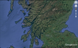 Staffa
Location: 53.15° N, 6.23° W
Elevation: 42 m
Staffa
Location: 53.15° N, 6.23° W
Elevation: 42 m

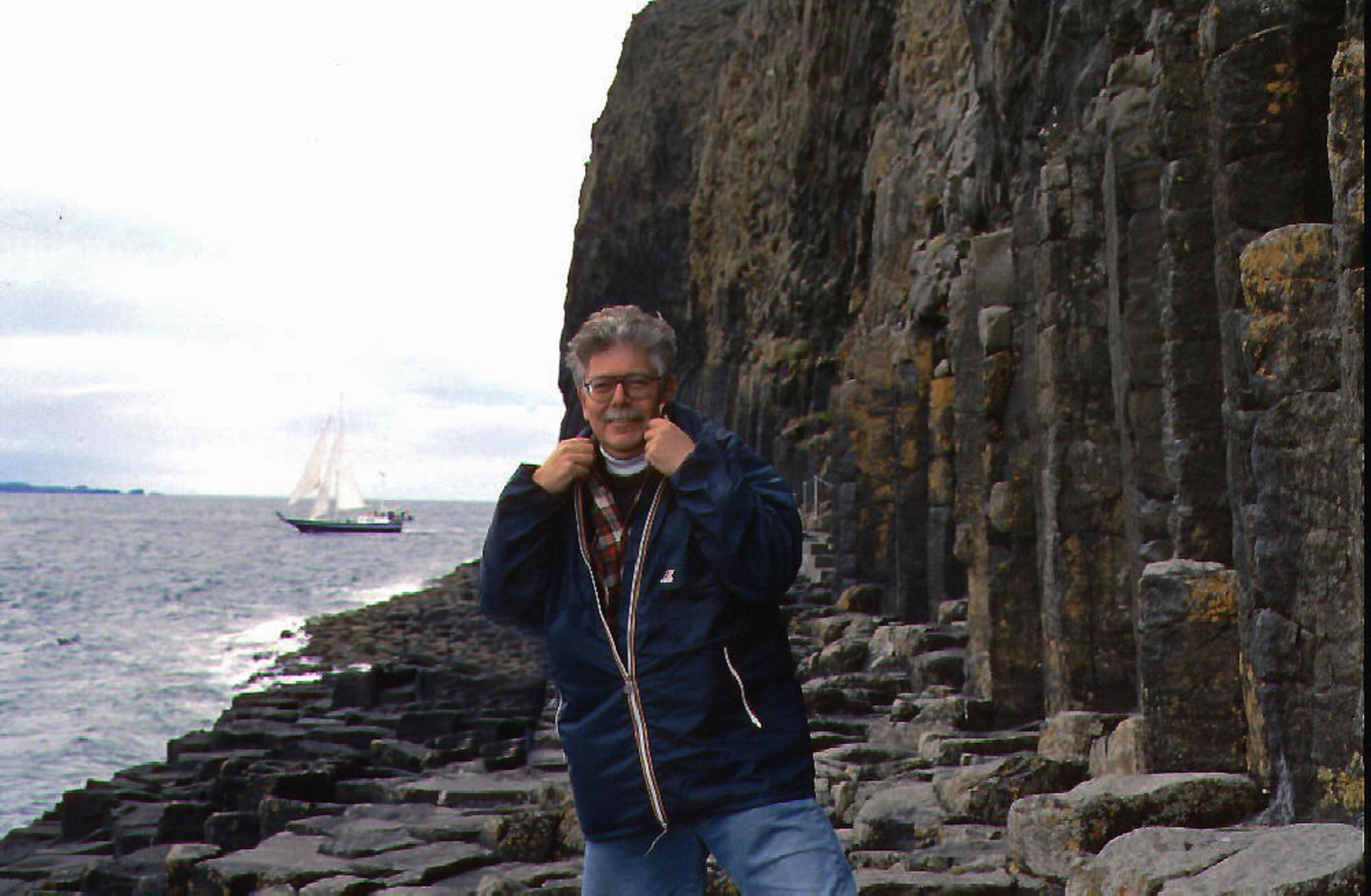
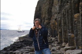
 Staffa, September 1993
HOME
Staffa, September 1993
HOME
spread from Scotland out into the Atlantic Ocean beyond the
Outer Hebrides. After the last retreat of the ice around
20,000 years ago, sea levels were up to 125 m lower than at
present. Steadily rising sea levels since that time then further
isolated this little island, which is entirely of volcanic origin. It
consists of a basement of tuff, underneath colonnades of a black
fine-grained Tertiary basalt, overlying which is a third layer of
basaltic lava lacking a crystalline structure. By contrast, slow
cooling of the second layer of basalt resulted in an extraordinary
pattern of predominantly hexagonal columns which form the faces and walls of the principal caves.
The lava contracted towards each of a series of equally spaced centres as it cooled and solidified
into prismatic columns. The columns typically have three to eight sides, six being most common.
The columns are also divided horizontally by cross joints.
Similar formations are found at the Giant`s Causeway in Nothern Ireland, on the island of Ulva and
at Ardmeanach on the Isle of Mull. Grooves in the roof of MacKinnon's cave indicate either a
pyroclastic flow or a series of eroded ash falls in the rock above the columnar basalt.The 'Staffa
Group' is the name given to the series of olivine tholeiite basalts found in the vicinity of Mull which
erupted 55–58 million years ago.
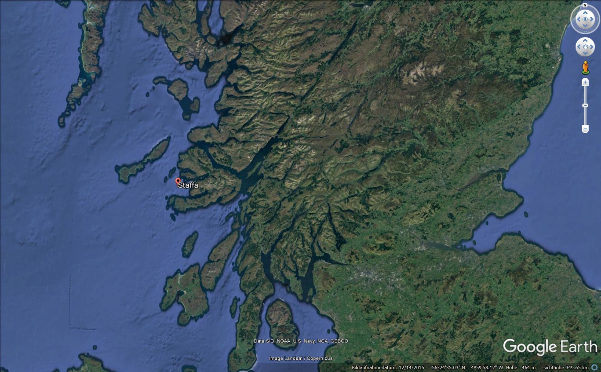 Staffa
Location: 53.15° N, 6.23° W
Elevation: 42 m
Staffa
Location: 53.15° N, 6.23° W
Elevation: 42 m

 Staffa, September 1993
HOME
Staffa, September 1993
HOME