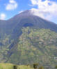
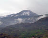
Tungurahua
Location: 1.467° N, 78.442° W
Elevation: 5.023 m


|
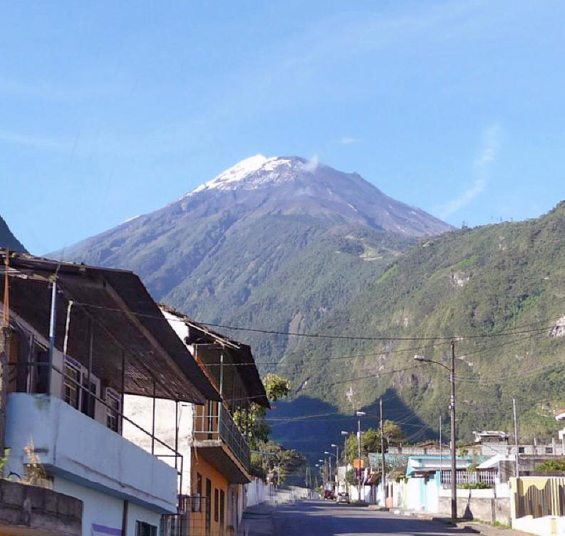
Tungurahua, a steep-sided andesitic-dacitic stratovolcano is one of Ecuador's most active volcanoes. Three major volcanic edifices have been sequentially constructed since the mid-Pleistocene over a basement of metamorphic rocks. Tungurahua II was built within the past 14,000 years following the collapse of the initial edifice. Tungurahua II itself collapsed about 3000 years ago and produced a large debris-avalanche deposit and a horseshoe-shaped caldera open to the west, inside which the modern glacier-capped stratovolcano (Tungurahua III) was constructed. Historical eruptions have all originated from the summit crater. They have been accompanied by strong explosions and sometimes by pyroclastic flows and lava flows that reached populated areas at the volcano's base. Prior to a long-term eruption beginning in 1999 that caused the temporary evacuation of the city of Baños at the foot of the volcano, the last major eruption had occurred from 1916 to 1918. (Global Volcanism Program)
Photos: Rolf Cosar Febr. 1987