Ubinas
Summit Elevation: 5672 m
Latitude: 16.355°S
Longitude: 70.903°W
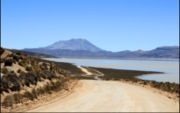
A small, 1.4-km-wide caldera cuts the top of Ubinas, Peru's most active volcano, giving it a truncated appearance.
Ubinas is the northernmost of three young volcanoes
located along a regional structural lineament about 50 km
behind the main volcanic front of Perú. The growth and
destruction of Ubinas I volcano was followed by
construction of Ubinas II volcano beginning in the mid-
Pleistocene. The upper slopes of the andesitic-to-rhyolitic
Ubinas II stratovolcano are composed primarily of
andesitic and trachyandesitic lava flows and steepen to
nearly 45 degrees. The steep-walled, 150-m-deep summit caldera contains an ash cone with a 500-m-
wide funnel-shaped vent that is 200 m deep. Debris-avalanche deposits from the collapse of the SE
flank of Ubinas about 3700 years ago extend 10 km from the volcano. Widespread plinian pumice-fall
deposits from Ubinas include one of Holocene age about 1000 years ago. Holocene lava flows are
visible on the volcano's flanks, but historical activity, documented since the 16th century, has consisted
of intermittent minor-to-moderate explosive eruptions. (Global Volcanic Program)
click to enlarge
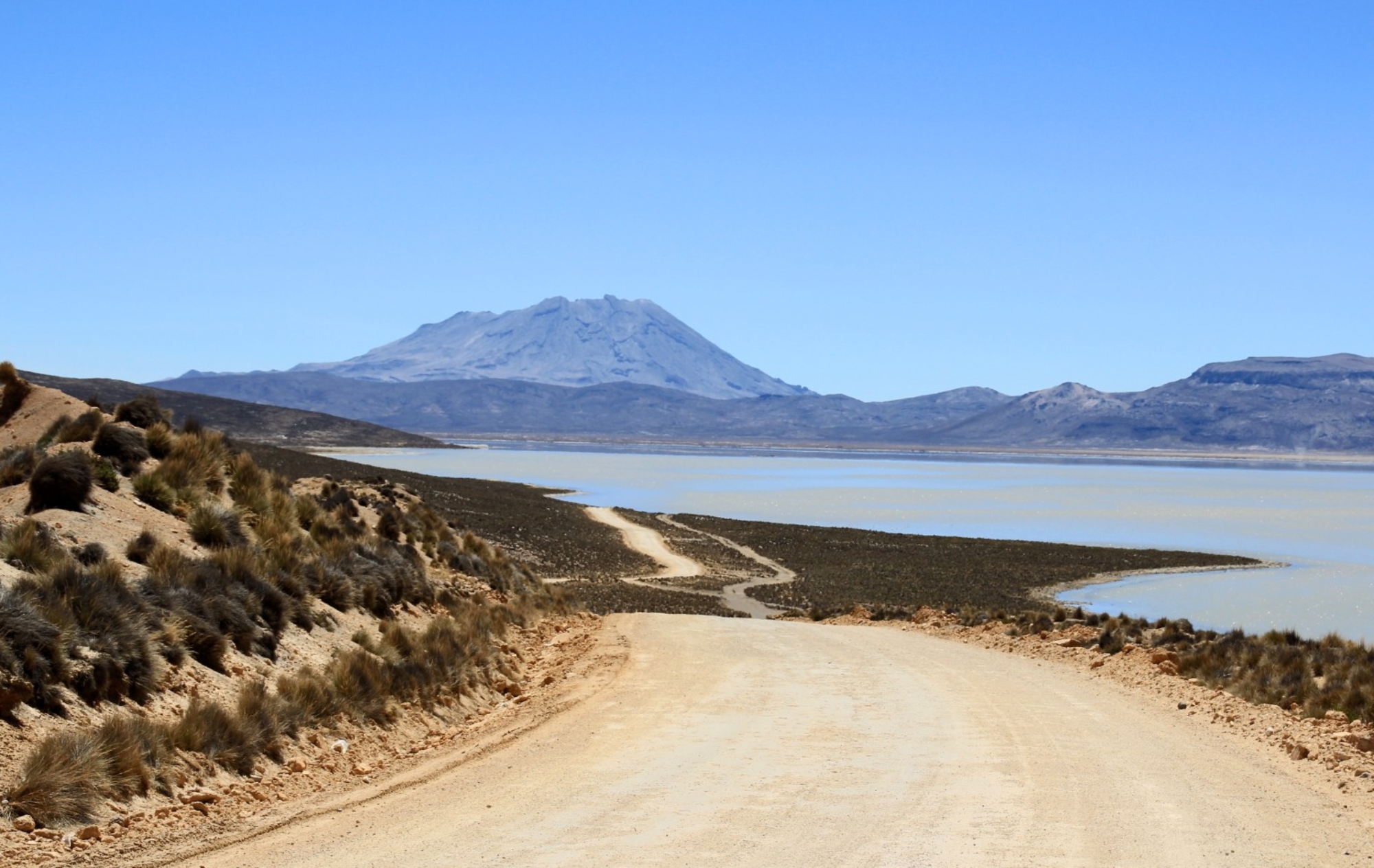
most active volcano, giving it a truncated appearance.
Ubinas is the northernmost of three young volcanoes
located along a regional structural lineament about 50 km
behind the main volcanic front of Perú. The growth and
destruction of Ubinas I volcano was followed by
construction of Ubinas II volcano beginning in the mid-
Pleistocene. The upper slopes of the andesitic-to-rhyolitic
Ubinas II stratovolcano are composed primarily of
andesitic and trachyandesitic lava flows and steepen to
nearly 45 degrees. The steep-walled, 150-m-deep summit caldera contains an ash cone with a 500-m-
wide funnel-shaped vent that is 200 m deep. Debris-avalanche deposits from the collapse of the SE
flank of Ubinas about 3700 years ago extend 10 km from the volcano. Widespread plinian pumice-fall
deposits from Ubinas include one of Holocene age about 1000 years ago. Holocene lava flows are
visible on the volcano's flanks, but historical activity, documented since the 16th century, has consisted
of intermittent minor-to-moderate explosive eruptions. (Global Volcanic Program)
click to enlarge
")

 - Volcan Ubinas")

 Panoramas
 click on panorama
HOME
click on panorama
HOME


most active volcano, giving it a truncated appearance.
Ubinas is the northernmost of three young volcanoes
located along a regional structural lineament about 50 km
behind the main volcanic front of Perú. The growth and
destruction of Ubinas I volcano was followed by
construction of Ubinas II volcano beginning in the mid-
Pleistocene. The upper slopes of the andesitic-to-rhyolitic
Ubinas II stratovolcano are composed primarily of
andesitic and trachyandesitic lava flows and steepen to
nearly 45 degrees. The steep-walled, 150-m-deep summit caldera contains an ash cone with a 500-m-
wide funnel-shaped vent that is 200 m deep. Debris-avalanche deposits from the collapse of the SE
flank of Ubinas about 3700 years ago extend 10 km from the volcano. Widespread plinian pumice-fall
deposits from Ubinas include one of Holocene age about 1000 years ago. Holocene lava flows are
visible on the volcano's flanks, but historical activity, documented since the 16th century, has consisted
of intermittent minor-to-moderate explosive eruptions. (Global Volcanic Program)
click to enlarge
")

 - Volcan Ubinas")

 Panoramas
click on panorama
HOME
Panoramas
click on panorama
HOME
